Public domain image from Pixabay.com
TRAIL NOW Frequently Asked Questions (FAQ)
What are the goals of Trail Now?
Our goal is to convert the Rail Corridor to a world-class Trail by 2018. The corridor is simply not suited for efficient rail transportation, nor is it correctly positioned geographically to house a successful passenger train. This property could produce one of the greatest and most beautiful pedestrian trails in our nation, and that's exactly what Trail Now is proposing. To learn more, click here. [back to top]
Does Trail Now want to remove all of the tracks?
No. Our primary focus is on the Central Reach, which runs from Santa Cruz to Aptos. In fact, large portions of the train track in other areas can remain in place. These areas do not present the physical constraints of the Central Reach, and would likely be able to accommodate a trail adjacent to the tracks at a reasonably safe distance. [back to top]
Is Trail Now against all Rail?
No. Mass transportation is a wonderful thing, but only if it is designed and implemented correctly. Although many years in the making, the current plan combining train with pedestrian trail is too expensive, too disruptive, requires too many compromises, and achieves too little positive impact. Despite the best intentions of the planners, the proposed passenger train does not serve our best interests. [back to top]
Would a rail-with-trail work in our corridor?
No. In August 2002, the U.S. Department of Transportation (USDOT) published the document Rails-With-Trails: Lessons Learned. This document remains the most comprehensive and authoritative resource for rail-with-trail development. In the document, it states: “A rail-with-trail in very steep or rugged terrain or with numerous bridges and trestles simply may not be feasible given the need to keep a minimal setback from the tracks, meet ADA requirements, allow railroad maintenance access, and still have a reasonable construction budget.” Our corridor has over 20 bridges with two freeway crossings and miles of physically constrained segments. Costs for the trail are estimated at $127 million, and are only expected to go up. Please reference page 65 of the USDOT document, which can be found here. A video discussing the width and physical constraints of our corridor can be found here. [back to top]
Does it make sense to build the trail first, and determine rail later?
No. In our opinion this is poor planning that is ripe for conflict. Typically, a rail-with-trail is built alongside an already existing active rail line. The type, speed, and frequency of the trains are known variables, and the trail can be built to safely accommodate the train. Building the trail first is a case of putting the cart before the horse. Remember, it's rail-with-trail; not trail-with-rail. [back to top]
Would the proposed rail-with-trail be safe?
No. There are many examples of successful rail-with-trail projects throughout the United States. However, these trails are typically set back 25 feet or more from the centerline of the train tracks. The national average setback is 33 feet. Since our corridor is so narrow, the current plan will have 8.5 to 10.0 foot setbacks from Santa Cruz to Aptos. These low setbacks are typically reserved for railroad workers, or short bottle-neck sections. The Federal Railroad Administration (FRA) has stated that the setback distance for the general public should be much greater than the 8.5 foot setback allowed for railroad workers. Please refer to page 63 in the USDOT document, Rails-With-Trails: Lessons Learned. [back to top]
Who did the trail designer consult with prior to making the plan?
As part of the Master Plan, the trail designer relied on input from the current operator. We believe this to be a significant error. Keep in mind, the current operator provides seasonal tourist trains and limited freight, which is very different from providing passenger rail service to the general public. This is the equivalent of consulting with the Watsonville Municipal Airport, prior to building a brand new International Terminal. What would have been more appropriate is to seek input from passenger rail service providers analogous to what's being planned. It's unlikely the Master Plan would exist in its current form had the RTC consulted with CalTrain, SMART, SCRRA, or any other operator that provides passenger service to the general public. [back to top]
What setbacks do other rail-with-trail projects have?
In Healdsburg, Sonoma-Marin Area Rail Transit (SMART) concluded that the Foss Creek Trail needs a minimum setback of 15 feet in places where the train is going 25 miles per an hour or less. The setback increases to 25 feet if the speed is above 25 miles per hour. The Southern California Regional Rail Authority (SCRRA) determined a minimum setback of 25 feet when the trail is next to a train going 40 miles per hour or under. In San Diego County, the recommended minimum setback for the Coastal and Inland Rail-With-Trail is 20 feet. [back to top]
What’s wrong with the current plan for the trail?
The current plan is known as the Monterey Bay Sanctuary Scenic Trail Network (MBSST). The plan calls for the trail to be built next to the train tracks. This is known as a rail-with-trail. A traditional rail-trail would have the trail built in place of the train tracks. By accommodating the train tracks, the result is an overly expensive trail that falls far short of the corridors true potential. For a video detailing the problems with the current rail-with-trail plan, click here. [back to top]
Why is the trail so expensive?
The current plan is extremely expensive, estimated to cost $127 million, or approximately $4.0 million per mile. Keep in mind; this is only the cost of the trail. The cost of the train is in addition to the $127 million. By accommodating the train, the rail-with-trail plan would require over 20 new bike/pedestrian bridges to be built. This includes two freeway crossings. Additionally, rather than going down the middle of the corridor, the plan would need to excavate hillsides and build expensive retaining walls. Lastly, portions of the corridor are so narrow that the tracks would need to physically be moved to make room for the trail. [back to top]
Is the $127.0 million estimate realistic?
No. The cost is grossly underestimated. For example, the cost of two freeway crossings and two major bridges in Aptos is estimated at $900,000 each. This is considerably lower than comparable projects. Additionally, the plan does not appear to take into account the costs of excavation and reinforced embankments that would be required for large portions of the corridor. [back to top]
How much would it cost to replace the tracks with a trail?
Initial estimates indicate a cost of $68.0 million. However, other estimates indicate an even lower cost between $20.0 million to $40.0 million. Keep in mind, this includes usage of the Capitola trestle, which is not included in the current plan. [back to top]
What about the Capitola trestle?
This is not included in the $127.0 million dollar estimate for the trail, and that portion of the trail would require a surface street reroute. If the corridor were railbanked, the trestle could easily be retrofitted as a bicycle/pedestrian bridge. [back to top]
How many trains would there be?
Trains would run from 6:00 am to 9:00 pm with up to 60 trains per day. Please refer to page xi of the Regional Transportation Commission (RTC) Rail Feasibility Study for a breakdown of the proposed scenarios. [back to top]
How fast would the trains be going?
Peak speed for the trains is between 45 to 55 miles per hour, with an average of 25 to 35 miles per hour. Train speed is discussed on page 64 of the RTC Rail Feasibility Study. [back to top]
Would the trains be electric?
No. The feasibility study and estimated costs were based on diesel-powered trains. Electrifying the corridor would add significant costs to the project. For additional information on rail technology, refer to page 29 of the RTC Rail Feasibility Study. [back to top]
Would the train reduce Highway 1 gridlock?
No. Passenger train ridership is estimated at most to be 2,750 people per day per day versus the 100,000 cars per day on Highway 1. Ridership forecasts are discussed on page 108 of the RTC Rail Feasibility Study. Keep in mind, a boarding represents a one-way trip. This means that one person would equal two boardings. [back to top]
Will the trains be noisy?
Yes. Horns will be blown at distances of 1320 feet (1/4 mile) before all traffic crossings and stations at 96 to 110 decibels. To see and hear an example of the train recommended in the RTC Rail Feasibility Study, click here. [back to top]
What about quite zones?
A January 2000 study by the Federal Railroad Administration (FRA) found a 62% increase in accidents at crossings where train horns were banned (i.e. quiet zones). Additionally, quiet zones require additional expensive equipment, and the cost is not included in the RTC Rail Feasibility Study. To see the FRA study on quiet zones, click here. [back to top]
How much would the train cost?
Costs vary depending on the scenario. Estimates range from $31.5 to $176 million to construct the railway. Annual maintenance ranges from $3.8 to $14.0 million per year. However, we believe these costs estimates are unreasonably low, making it less expensive than the nation’s lowest cost light rail system built (San Diego’s Blue Line), in which no rail was replaced (source: US Federal Reserve Bank ofSt. Louis). A summary of costs are discussed on page xii of the RTC Rail Feasibility Study. [back to top]
What’s not included in the cost for the train?
Estimated costs do not include: walking/biking trail; new auto/vehicle parking facilities for passenger vehicles; additional security; EMS services; train stations; road infrastructure; additional pedestrian bridge over freeway; additional shuttle buses from stations to connect UCSC, Cabrillo, and the general Watsonville area. [back to top]
How would the train be funded?
The RTC feasibility study cites a number of sources. However, we believe that the train would not qualify for Federal funds, and the majority of the costs would require new, ongoing local taxes. The current RTC plan is to include funding for the train in a 2016 transportation tax measure. It’s been reported that additional tax measures would be required in 2018 and 2020. A funding assessment can be found on page xii of the RTC Rail Feasibility Study. [back to top]
Does Santa Cruz County have the population necessary for a train?
No. Successful passenger rail needs to be located in, or connected to, an area with population of 1.0 million or more. Current population for Santa Cruz County is 262,000. High levels of growth would be required to support the proposed rail service. For a list of cities with light rail systems, click here. [back to top]
What about the trees and vegetation?
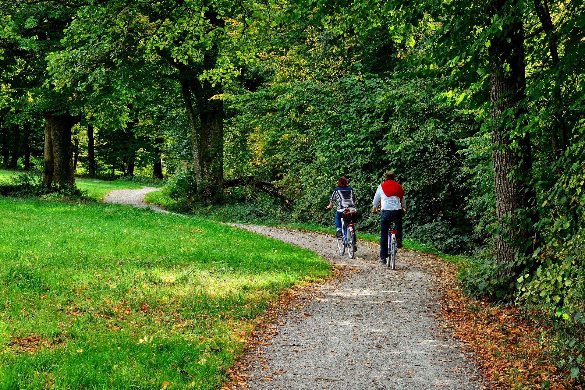
If railbanked, the corridor would become a linear park with trees and vegetation growing next to and over the trail. However, a train would have a dramatic effect on the landscape of our County. Trees and vegetation do not mix well with rail service, and the corridor would need to be clear cut to make way for the train. To see how a video on how the train would alter the landscaping of the corridor, please click here. [back to top]
Don’t we have to use the corridor for rail service?
No. The corridor was purchased using $11.0 million of Prop 116 funds, which requires some type of passenger rail service. Currently, that requirement is fulfilled by the seasonal Train to Christmas Town. Ultimately, once rail service is determined not to be viable, the $11.0 million can be returned. [back to top]